 New topic
 Printable
That looks like to much effort...I'll show u instead 
 | |
- E-mail - orgNote -  Report post to moderator Report post to moderator |
dreamfactory313 said: Dearborn, Michigan is a suburb of Detroit, Michigan and home to 100,000 people. About a third of Dearborn's residents have ancestry from the Middle East which helps make metro Detroit the largest population of Middle Eastern people anywhere outside the Middle East.
In January 2005, a new Arab American National Museum opened as a result of this large concentrated population. The city is also home to the Islamic Center of America, the largest mosque in North America and the Dearborn Mosque. Because of the Arab influence in cultural east side of Dearborn, store signs and billboards written in Arabic are common sights. Dearborn is home to Ford Motor Company, the Ford River Rouge Plant, built by Henry Ford to make Ford Model T components, and later the birthplace (and former production line) of the Ford Mustang. It currently produces Ford F150 trucks. At one time the plant employed 120,000 people and produced finished vehicles from iron ore and sand. Dearborn is also home to Fordson High School, the first million dollar high school within the nation. http://en.wikipedia.org/w...,_Michigan The median income for a household in the city was $44,560, and the median income for a family was $53,060. Males had a median income of $45,114 versus $33,872 for females. The per capita income for the city was $21,488. About 12.2% of families and 16.1% of the population were below the poverty line, including 24.4% of those under age 18 and 7.6% of those age 65 or over. Ditto. | |
| - E-mail - orgNote - Report post to moderator |
CarrieMpls said: Everything below is from http://en.wikipedia.org/w...inneapolis
Minneapolis is the largest city in the U.S. state of Minnesota and is the county seat of Hennepin County. The city lies on both banks of the Mississippi River, just north of the river's confluence with the Minnesota River, and adjoins Saint Paul, the state's capital. Known as the Twin Cities, these two cities form the core of Minneapolis-St. Paul, the 16th-largest metropolitan area in the United States, with about 3.2 million residents. The city of Minneapolis' population is estimated at 372,811 people as of 2005. Once a hub for timber milling, and flour milling, Minneapolis is the primary business center in the vast expanse between Chicago and Seattle, Washington.[3] The city is largely liberal, and in part of its role as county seat, it has worked toward improving the health and welfare of all residents, including the less fortunate. Public park systems are modeled after Minneapolis, where lakes are used for recreation year-around, and a park is within one-half mile (.8 km) of every home. Regional theater was pioneered at the city's Guthrie Theater and is part of a strong local tradition in the performing arts. Minneapolis made dramatic changes to rectify discrimination as early as 1886 when Martha Ripley founded Maternity Hospital for both married and unmarried mothers.[12] When the country's fortunes turned during the Great Depression, the violent Teamsters Strike of 1934 resulted in laws acknowledging worker's rights.[13] In 1945, mayor Hubert H. Humphrey skillfully brought opposing interests together and forged the Minnesota Democratic-Farmer-Labor Party.[14] Minneapolis contended with white supremacy, participated in desegregation and the African-American civil rights movement, and in 1968 was the birthplace of the American Indian Movement.[15] Minneapolitans are a diverse group of people with ancestors from five continents. Their heritage of welcoming newcomers began in the 19th and continues into the 21st century. During the 1850s and 1860s, new settlers arrived from New England and New York, and during the mid-1860s, Scandinavians from Sweden, Norway, and Denmark began to call the city home. Later, immigrants came from Germany, Italy, Greece, Poland, and southern and eastern Europe. Jewish people came from Russia and eastern Europe, settling primarily on the city's north side before moving in large numbers to the western suburbs in the 1950s and 1960s.[25] Asians came from China, the Philippines, Japan, and Korea. Two groups came for a short while during U.S. government relocations, Japanese during the 1940s, and Native Americans during the 1950s. From 1970 onward, Asians arrived from Vietnam, Laos, Cambodia, and Thailand. Beginning in the 1990s, a large Latino population arrived. Since the 1990s, refugees arrived from Africa, many from Somalia, from Southeast Asia, and Latin America.[26] Estimates in 2005 show the population of Minneapolis to be 372,811, a 2.6% drop since the 2000 census.[1] The population grew until 1950 when the census peaked at 521,718, and then declined as people moved to the suburbs until about 1990. The number of African-Americans, Asians, and Hispanics is growing. Non-whites are now about one fifth of the city's residents.[27] The region is second only to New York City in live theater per capita[41] and is the third-largest theater market in the U.S. Minneapolitans support 12 large art, cultural, science, and historical museums alongside smaller galleries and museums, 4 large ballet, dance, and folkdance companies, as well as filmmakers groups and numerous theater companies.[46] The city publishes updates to The Minneapolis Plan for Arts and Culture which has produced results such as the formal recognition of the Northeast Arts District.[47] The Minneapolis park system has been called the best-designed, best-financed and best-maintained in America.[62] Foresight, donations and effort by community leaders enabled Horace Cleveland to create some of his best landscape architecture, preserving geographical landmarks and linking them with boulevards and parkways.[63] The city's Chain of Lakes is connected by bike, running, and walking paths and used for swimming, fishing, picnics, boating, and ice skating. A parkway for cars, a bikeway for riders, and a walkway for pedestrians run parallel paths along the 52 mile (83 km) route of the Grand Rounds Scenic Byway.[64] | |
| - E-mail - orgNote - Report post to moderator |
I live in Philadelphia and Prince usually comes to town at least every 2 years,last year he was here with Tamar! See ya soon, Prince! | |
| - E-mail - orgNote - Report post to moderator |
Cambridge, Massachusetts
Location in Massachusetts Coordinates: 42°22′30″N, 71°06′22″W Country United States State Massachusetts County Middlesex County Settled 1630 Incorporated 1636 Government - Type Mayor-council city - Mayor Kenneth Reeves (D) Area - City 7.1 sq mi (18.5 km²) - Land 6.4 sq mi (16.7 km²) - Water 0.7 sq mi (1.8 km²) Elevation 40 ft (12 m) Population (2000) - City 101,354 - Density 15,766.1/sq mi (6,087.3/km²) Time zone Eastern (UTC-5) - Summer (DST) Eastern (UTC-4) Cambridge is a city in the Greater Boston area of Massachusetts, United States. It was named in honor of Cambridge, England. Cambridge is most famous for the two prominent universities that call it home: Harvard University and the Massachusetts Institute of Technology. As of the 2000 census, the city population was 101,355. It is the fifth most populous city in the state. Demographics As of the censusGR2 of 2000, there were 101,355 people, 42,615 households, and 17,599 families residing in the city. The population density was 6,086.1/km² (15,766.1/mi²), making Cambridge the 5th most densely populated city in the U.S.[2] There were 44,725 housing units at an average density of 2,685.6/km² (6,957.1/mi²). The racial makeup of the city was 68.10% White, 11.92% Black or African American, 0.29% Native American, 11.88% Asian, 0.08% Pacific Islander, 3.19% from other races, and 4.56% from two or more races. 7.36% of the population were Hispanic or Latino of any race. There were 42,615 households out of which 17.6% had children under the age of 18 living with them, 29.1% were married couples living together, 9.7% had a female householder with no husband present, and 58.7% were non-families. 41.4% of all households were made up of individuals and 9.2% had someone living alone who was 65 years of age or older. The average household size was 2.03 and the average family size was 2.83. In the city the population was spread out with 13.3% under the age of 18, 21.2% from 18 to 24, 38.6% from 25 to 44, 17.8% from 45 to 64, and 9.2% who were 65 years of age or older. The median age was 30 years. For every 100 females there were 96.1 males. For every 100 females age 18 and over, there were 94.7 males. The median income for a household in the city was $47,979, and the median income for a family was $59,423. Males had a median income of $43,825 versus $38,489 for females. The per capita income for the city was $31,156. About 8.7% of families and 12.9% of the population were below the poverty line, including 15.1% of those under age 18 and 12.9% of those age 65 or over. Cambridge was ranked as one of the most liberal cities in America. Higher education Episcopal Divinity School Harvard University Lesley University Longy School of Music Massachusetts Institute of Technology Weston Jesuit School of Theology The Normal Whores Club | |
| - E-mail - orgNote - Report post to moderator |

cali Say it's just a dream...
U open up ur eyes and come 2 realize u simply imagined this So u lean over and give her a kiss Here on earth, here on earth, with u it's not so bad Here on earth, here on earth eye don't feel so sad Stay right here | |
| - E-mail - orgNote - Report post to moderator |

It sucks. And we call it "The Bucket" | |
| - E-mail - orgNote - Report post to moderator |
Santa Barbara is located about 85 miles west-northwest of Los Angeles, along the Pacific coast. This stretch of coast along southern Santa Barbara County is often referred to as the "American Riviera" because of its Mediterranean climate. The Santa Ynez Mountains, an east-west trending range, rise dramatically behind the city, with several peaks exceeding 4,000 feet. Covered with chaparral and with sandstone outcrops, they make a famously scenic backdrop to the town. Nearer to town, and directly east and adjacent to Mission Santa Barbara, is a hill known locally as the "Riviera" or "Alameda Padre Serra" (shortened APS) for the street that traverses it, which is built up with expensive homes. The city sustained heavy damage in an earthquake on June 29, 1925, which was followed by substantial rebuilding.
Much of the architecture in the city is Spanish Colonial in style, although much of it was actually constructed starting in the early 20th century in connection with the Mission or Spanish Revival movement. White buildings with terra cotta tile roofs are a trademark sight. The city has enacted strict ordinances to prevent erosion of this image, with some success. For example, there are no billboards anywhere in town, and none at all on the main freeway through town for almost twenty miles in both directions; in addition there is a strict sign ordinance for businesses, with no excessively large lettering allowed. According to the United States Census Bureau, the city has a total area of 107.3 km² (41.4 mi²). 49.2 km² (19.0 mi²) of it is land and 58.1 km² (22.4 mi²) of it (54.17%) is water. this is because the official city limit extends exactly four miles south into the ocean, and in addition a long "finger" of the city extends out to sea and again inland, in order to make Santa Barbara Airport (adjacent to the University of California, Santa Barbara [UCSB]) contiguous with the city. | |
| - E-mail - orgNote - Report post to moderator |

karmatornado said: The racial makeup of the city was:
* 54.7% White * 44.8% Hispanic or Latino of any race * 26.0% from other races * 7.3% African American * 5.7% Asian * 4.4% from two or more races. * 1.0% Native American * 0.9% Pacific Islander Errrr.... ummmm.... that's WAY more than 100% | |
| - E-mail - orgNote - Report post to moderator |
http://en.wikipedia.org/w...California
Rockridge is a neighborhood and district in Oakland, California. Rockridge is generally defined as the area east of Telegraph Avenue, south of the Berkeley city limits, west of the Oakland hills and north of the intersection of Pleasant Valley Avenue/51st Street and Broadway. Some residential portions of the neighborhood are considered upscale, and consist mainly of relatively large homes built between the 1920s and the 1950s. Other portions of the neighborhood consist of small bungalows and cottages that are popular for their charm and character. (Stax says: "I live in a charming bungalow." The main street of Rockridge is College Avenue, home to many cafes and restaurants, upscale retail stores, and several bookstores. At the foot of College Avenue is the California College of the Arts (formerly California College of Arts and Crafts, or CCAC). College Avenue continues north through the Elmwood district in Berkeley and ends at Bancroft Way and the UC Berkeley campus. Highway 24 runs through the center of the district on its way east to the suburban city of Walnut Creek and its surrounding towns. The Rockridge BART station is located in the center of Rockridge, where College Avenue and Highway 24 cross. AC Transit bus lines 7, 51 and 59 serve the center of the neighborhood, while line E runs along Claremont Avenue and lines 12, 40/40L, CB, and V run along its edges. Rockridge is named for the outcroppings of rock at the northern end of the long shutter ridge formed by the Hayward Fault which encloses the linear valley in which the Montclair district of Oakland is situated. An example of this rock can be seen at an abandoned quarry adjacent to the Rockridge Shopping Center on Pleasant Valley Road. a psychotic is someone who just figured out what's going on | |
| - E-mail - orgNote - Report post to moderator |

Stax said: http://en.wikipedia.org/wiki/Rockridge,_Oakland,_California
Rockridge is a neighborhood and district in Oakland, California. Rockridge is generally defined as the area east of Telegraph Avenue, south of the Berkeley city limits, west of the Oakland hills and north of the intersection of Pleasant Valley Avenue/51st Street and Broadway. Some residential portions of the neighborhood are considered upscale, and consist mainly of relatively large homes built between the 1920s and the 1950s. Other portions of the neighborhood consist of small bungalows and cottages that are popular for their charm and character. (Stax says: "I live in a charming bungalow." The main street of Rockridge is College Avenue, home to many cafes and restaurants, upscale retail stores, and several bookstores. At the foot of College Avenue is the California College of the Arts (formerly California College of Arts and Crafts, or CCAC). College Avenue continues north through the Elmwood district in Berkeley and ends at Bancroft Way and the UC Berkeley campus. Highway 24 runs through the center of the district on its way east to the suburban city of Walnut Creek and its surrounding towns. The Rockridge BART station is located in the center of Rockridge, where College Avenue and Highway 24 cross. AC Transit bus lines 7, 51 and 59 serve the center of the neighborhood, while line E runs along Claremont Avenue and lines 12, 40/40L, CB, and V run along its edges. Rockridge is named for the outcroppings of rock at the northern end of the long shutter ridge formed by the Hayward Fault which encloses the linear valley in which the Montclair district of Oakland is situated. An example of this rock can be seen at an abandoned quarry adjacent to the Rockridge Shopping Center on Pleasant Valley Road. | |
| - E-mail - orgNote - Report post to moderator |
| - E-mail - orgNote - Report post to moderator |
East Bay
Looking west from the Berkeley Hills. Visible are Berkeley (Center), San Francisco (Upper Left), Oakland (Lower Left), Marin County (Upper Right), and Richmond (Lower Right). Main article: East Bay (San Francisco Bay Area) The eastern side of the bay, consisting of Alameda and Contra Costa counties, is known locally as the East Bay. The East Bay is split into two regions, the inner East Bay, which sits on the Bay coastline, and the outer East Bay, consisting of inland valleys separated from the inner East Bay by hills and mountains. Berkeley as seen from the Claremont Canyon reserve. The large tower in the center of the photo is on the campus of the University of California, Berkeley.The inner East Bay includes the cities of Oakland, Hayward, Fremont, Berkeley, and Richmond, as well as many smaller suburbs such as Alameda, Castro Valley, Newark, Union City, Emeryville, Albany, San Leandro, El Sobrante,Pinole, Piedmont and El Cerrito. The inner East Bay is more urban, more densely populated, has a much older building stock (built before World War II) and a more ethnically diverse population. Oakland hosts the region's largest seaport and professional sports franchises in basketball, football, and baseball. As with many inner urban areas the Inner East Bay also features a high accumulation of crime as well as other socio-economic problems. According to the FBI Uniformed Crime Reports, more than 50% of all homicides in the Bay Area in 2002 occurred within the city limits of Oakland and Richmond. The homicide rates have steadily increased, as 2005 had the highest homicide rates for both Richmond and Oakland. The outer East Bay consists the eastern portions of Alameda and Contra Costa counties and includes the cities of Orinda, Walnut Creek, Concord, Martinez, Pittsburg, Antioch, and Pleasant Hill, and Lafayette to the north (also referred as Central Contra Costa County) and the cities of Dublin, Pleasanton, Livermore, Danville, San Ramon to the south (sometimes referred to as the Livermore-Amador Valley or the Tri-Valley), as well as other smaller towns, such as Alamo and Brentwood I was born in Oakland, currently live in Richmond/El Cerrito, go to school in Pleasant Hill(Diablo Valley College) and hang out in Pittsburg, Berkeley, and San Francisco "We may deify or demonize them but not ignore them. And we call them genius, because they are the people who change the world." | |
| - E-mail - orgNote - Report post to moderator |

Seattle, Washington USA
 [Edited 5/22/07 14:25pm] | |
| - E-mail - orgNote - Report post to moderator |

Seattle, Washington. USA. Noah Sealth, chief of the local Suquamish Native American tribe, was one of the founders of the city. Seattle is named after him. Before it got the name Seattle in late 1852, the city was known as Duwamps. The Great Seattle Fire of 1889 burnt up most of the first Seattle downtown. It was rebuilt within a year, literally on top of the remains of the older downtown. You can still see sections of the original downtown on the colorful Seattle Underground Tour. 3.2 million people live in the Greater Seattle Area. About 570,000 live in Seattle itself. More than 75% of Seattle residents have internet access at home. The Seattle WiFi Map Project recently mapped out thousands of wireless networks in Seattle. Seattle is one of the fittest cities in the country, especially for walkers and bikers. Seattle has the highest per-capita music and dance attendance in the country, with 80 live music clubs (not counting the movable dance clubs and shows) and 15 symphony orchestras. The Seattle International Film Festival in mid-May to June showcases world film and new world filmmakers. Seattle has 29 professional theatres, 56 fringe theatre companies and seven theatre schools. Bumbershoot, over Labor Day weekend, is one of the largest entertainment festivals in the world. Ballard, in north Seattle, was once a Norweigan fishing village. The Alaskan fishing fleet still winters there before heading out on salmon runs. The Nordic Heritage Museum is the country's only museum honoring the heritage of people from the five Nordic countries. Ray Charles, Quincy Jones, Jimi Hendrix and Ernestine Anderson all lived in Central and South Seattle over the years. Seafair is a massive two-month summer festival that showcases the traditions and diversity of Puget Sound with parades, festivals, triathalons, hydroplane races and air shows. Alki Beach is one of the city's longest white sand beaches, 2 miles along the west side of West Seattle. | |
| - E-mail - orgNote - Report post to moderator |
my city's built on poles and we have hookers & drugs! | |
| - E-mail - orgNote - Report post to moderator |
PaisleyPark5083 said: Santa Barbara is located about 85 miles west-northwest of Los Angeles, along the Pacific coast. This stretch of coast along southern Santa Barbara County is often referred to as the "American Riviera" because of its Mediterranean climate. The Santa Ynez Mountains, an east-west trending range, rise dramatically behind the city, with several peaks exceeding 4,000 feet. Covered with chaparral and with sandstone outcrops, they make a famously scenic backdrop to the town. Nearer to town, and directly east and adjacent to Mission Santa Barbara, is a hill known locally as the "Riviera" or "Alameda Padre Serra" (shortened APS) for the street that traverses it, which is built up with expensive homes. The city sustained heavy damage in an earthquake on June 29, 1925, which was followed by substantial rebuilding.
Much of the architecture in the city is Spanish Colonial in style, although much of it was actually constructed starting in the early 20th century in connection with the Mission or Spanish Revival movement. White buildings with terra cotta tile roofs are a trademark sight. The city has enacted strict ordinances to prevent erosion of this image, with some success. For example, there are no billboards anywhere in town, and none at all on the main freeway through town for almost twenty miles in both directions; in addition there is a strict sign ordinance for businesses, with no excessively large lettering allowed. According to the United States Census Bureau, the city has a total area of 107.3 km² (41.4 mi²). 49.2 km² (19.0 mi²) of it is land and 58.1 km² (22.4 mi²) of it (54.17%) is water. this is because the official city limit extends exactly four miles south into the ocean, and in addition a long "finger" of the city extends out to sea and again inland, in order to make Santa Barbara Airport (adjacent to the University of California, Santa Barbara [UCSB]) contiguous with the city. I was born and raised in SB. I used to attend Cleveland School which was a hike if you had to walk the APS. i graduated from Santa Barbara High. I took some courses at SBCC. Fiesta still rocks expensive. I live 35 minutes away. Say it's just a dream...
U open up ur eyes and come 2 realize u simply imagined this So u lean over and give her a kiss Here on earth, here on earth, with u it's not so bad Here on earth, here on earth eye don't feel so sad Stay right here | |
| - E-mail - orgNote - Report post to moderator |
Imago said:  a psychotic is someone who just figured out what's going on | |
| - E-mail - orgNote - Report post to moderator |
july said:
Seattle, Washington. USA. Noah Sealth, chief of the local Suquamish Native American tribe, was one of the founders of the city. Seattle is named after him. Before it got the name Seattle in late 1852, the city was known as Duwamps. The Great Seattle Fire of 1889 burnt up most of the first Seattle downtown. It was rebuilt within a year, literally on top of the remains of the older downtown. You can still see sections of the original downtown on the colorful Seattle Underground Tour. 3.2 million people live in the Greater Seattle Area. About 570,000 live in Seattle itself. More than 75% of Seattle residents have internet access at home. The Seattle WiFi Map Project recently mapped out thousands of wireless networks in Seattle. Seattle is one of the fittest cities in the country, especially for walkers and bikers. Seattle has the highest per-capita music and dance attendance in the country, with 80 live music clubs (not counting the movable dance clubs and shows) and 15 symphony orchestras. The Seattle International Film Festival in mid-May to June showcases world film and new world filmmakers. Seattle has 29 professional theatres, 56 fringe theatre companies and seven theatre schools. Bumbershoot, over Labor Day weekend, is one of the largest entertainment festivals in the world. Ballard, in north Seattle, was once a Norweigan fishing village. The Alaskan fishing fleet still winters there before heading out on salmon runs. The Nordic Heritage Museum is the country's only museum honoring the heritage of people from the five Nordic countries. Ray Charles, Quincy Jones, Jimi Hendrix and Ernestine Anderson all lived in Central and South Seattle over the years. Seafair is a massive two-month summer festival that showcases the traditions and diversity of Puget Sound with parades, festivals, triathalons, hydroplane races and air shows. Alki Beach is one of the city's longest white sand beaches, 2 miles along the west side of West Seattle. Seattle, Washington From Wikipedia, the free encyclopedia City of Seattle Nickname: The Emerald City Location of Seattle in King County and Washington Coordinates: 47°36′N, 122°19′W Country United States State Washington County King County Incorporated December 2 1869 Government - Type Mayor-council - Mayor Greg Nickels (NP) Area - City 142.5 sq mi (369.2 km²) - Land 83.87 sq mi (217.2 km²) - Water 58.67 sq mi (152.0 km²) - Metro 8,186 sq mi (21,202 km²) Elevation 0–520 ft (0–158 m) Population (April 1, 2006)[1][2] - City 578,700 - Density 6,901/sq mi (2,665/km²) - Metro 3,263,497 Time zone PST (UTC-8) - Summer (DST) PDT (UTC-7) Website: www.seattle.gov Downtown Seattle is composed of a tightly-packed financial district along with residential areas and a panoramic waterfront.Seattle is the largest city in the Pacific Northwest region of the United States. It is located in the U.S. state of Washington between Puget Sound and Lake Washington, nearly 108 miles (174 km) south of the United States–Canadian border in King County, of which it is the county seat. Seattle was first settled November 14, 1851, by Arthur A. Denny and his crew, which would subsequently become known as the Denny party. Its first name was New York, then Duwamps, then finally it was renamed Seattle after Chief Noah Sealth who was chief of the two tribes living in the area ("Seattle" is an anglicized rendition of his last name). As of 2006, the city had an estimated population of 580,000[1] and a metropolitan population of approximately 4 million. Seattle is the hub for the Greater Puget Sound region. Its official nickname is the Emerald City, the result of a contest by a civic-minded association in the early 1980s to designate a pleasant nickname for the city;[3] the name alludes to the lush evergreen trees in the surrounding area. It is also referred to informally as the Gateway to Alaska, Queen City, and Jet City, due to the local influence of Boeing. (Seattle-area band Queensryche also wrote a song called "Jet City Woman".) Seattle residents are known as Seattleites. Seattle is often regarded as the birthplace of grunge music, and has a reputation for heavy coffee consumption; coffee companies founded in Seattle include Starbucks, Seattle's Best Coffee, and Tully's. There are also many successful independent artisanal espresso roasters and cafes. Seattle was the site of the 1999 meeting of the World Trade Organization, and the attendant demonstrations by anti-globalization activists. Researchers at Central Connecticut State University ranked Seattle the most literate city in America in 2005.[4] Moreover, a United States Census Bureau survey showed that Seattle has the highest percentage of college graduates of any major U.S. city.[5] Based on per capita income, Seattle ranks 36th of 522 studied areas in the state of Washington. Founding What is now Seattle has been inhabited since the end of the last glacial period (c. 8,000 B.C.—10,000 years ago). Archaeological excavations at West Point in Discovery Park, Magnolia confirm that the Seattle area has been inhabited by humans for at least 4,000 years and probably much longer.[6] tohl-AHL-too ("herring house") and later hah-AH-poos ("where there are horse clams") at the then-mouth of the Duwamish River in what is now the Industrial District had been inhabited since the 6th century BC.[7] The Dkhw'Duw'Absh and Xachua'Bsh people (now called the Duwamish Tribe) occupied at least 17 villages in the mid-1850s,[8] living in some 93 permanent longhouses (khwaac'ál'al) along Elliott Bay, Salmon Bay, Portage Bay, Lake Washington, Lake Sammamish, and the lower Duwamish, Black, and Cedar Rivers.[9] Most of the Denny Party, the most prominent of the area's early European American settlers (and historians), arrived at Alki Point on November 13, 1851. They called the spot "New York" at first to reflect their aspirations to create a great trading port, later appending Alki, a Chinook Jargon word meaning, roughly, by and by or someday, literally or ironically. They relocated their settlement to Elliott Bay in April 1852. The first plats for the Town of Seattle were filed on May 23, 1853. Nominal legal land settlement was established in 1855. The city was incorporated in 1865 and again in 1869, after having existed as an unincorporated town from 1867 to 1869.[10] Seattle was named after Chief Sealth, (si'áb Si'ahl, Noah Sealth), "high-status man" (appointed chief by the territorial governor) of the Duwamish and Suquamish tribes.[11] David Swinson ("Doc") Maynard, one of the city founders, was the primary advocate for naming the city after Chief Seattle. The name "Duwamish" is an Anglicization of Dkhw'Duw'Absh, "the People of the Inside", and a variation of that name is preserved in the name of the Duwamish River. Previously, the city had been known as Duwamps (or Duwumps), an earlier name settlers used for the river.[12] Major events Visitors to Kerry Park on Queen Anne Hill can see the Space Needle, the Downtown Seattle skyline, and Mount Rainier (to the right).Major events in Seattle's history include the Great Seattle Fire of 1889, which destroyed the central business district (but took no lives);[13] the Klondike gold rush, which made Seattle a major transportation center; the Alaska-Yukon-Pacific Exposition of 1909, which is largely responsible for the layout of the University of Washington campus;[14] the Seattle General Strike of 1919, the first general strike in the country;[15] the 1962 Century 21 Exposition, a World's Fair;[16] the 1990 Goodwill Games;[17] and the WTO Ministerial Conference of 1999, marked by street protests and a series of riots.[18]. A feature film, titled Battle in Seattle, is based on the riots and will be released at the end of 2007. The Major League Baseball All-star game was held at Safeco Field in Seattle during the 2001 season. On February 28, 2001, a state of emergency was declared after the Nisqually Earthquake, a magnitude 6.8 earthquake, rocked the region. Damage was moderate, but served as a reminder that the coastal Pacific Northwest — and the area around the Seattle Fault, in particular — is under a constant threat of earthquakes.[19] Seattle suffered its worst mass-killing since the 1983 Wah Mee massacre when a 28-year-old man named Kyle Aaron Huff committed the Capitol Hill massacre on March 25, 2006, followed later that year by an attempted spree killing by Naveed Afzal Haq that left one dead at the Jewish Federation building in July. Both were unusual, given that Seattle is relatively safe for a city its size. Its murder rate peaked in 1994 with 69 homicides. In 2004, Seattle's murder rate hit a 40-year low with 24 homicides. Seattle's crime rate has seen an increase in 2006, as have the crime rates in Tacoma and Lakewood, Washington. In December 2006, the Hanukkah Eve Wind Storm brought very heavy rain and disrupted power to much of the city. Economic history Seattle has a history of boom and bust cycles historically common in cities of its size. Seattle has been sent into precipitous decline by the aftermaths of its worst periods as a company town, but has typically used those periods to successfully rebuild infrastructure.[20] The Seattle Central Library, designed by Rem Koolhaas, is the result of a public vote on the "Libraries for All" bond measure approved by Seattle voters on November 3, 1998.The first such boom, covering the early years of the city, was fueled by the lumber industry. (It was during this period that the road now known as Yesler Way was nicknamed "Skid Road"[21] after the timber skidding down the street to Henry Yesler's sawmill. The term later entered the wider American vocabulary as Skid Row.) This boom was followed by the construction of an Olmsted-designed park system. The second and largest boom was the direct result of the Klondike Gold Rush of 1896, which ended the national depression that had begun with the Panic of 1893. On July 14, 1897, the S.S. Portland docked with its famed "ton of gold", and Seattle became the main transport and supply point for those heading north. The boom lasted well into the early part of the 20th century and funded the start-up of many new companies and products. In 1907, 19-year-old James E. Casey founded the American Messenger Company in Seattle with $100 borrowed from a friend which later became UPS. Other Seattle companies founded during this time period include Nordstrom and Eddie Bauer.[22] Downtown Seattle facing the Monorail station.Next came the shipbuilding boom in the early part of the 20th century, followed by the unused city development plan of Virgil Bogue. Seattle was the major point of departure during World War II for troops heading to the north Pacific, and Boeing manufactured many of the fighters and bombers. After the war, the local economy dipped but rose again with the expansion of Boeing, fueled by the growth of the commercial aviation industry.[23] When this particular cycle went into a major downturn in the late 1960s and early 1970s, many left the area to look for work elsewhere, and two local real estate agents put up a billboard reading "Will the last person leaving Seattle — Turn out the lights."[24][25] Seattle remained the corporate headquarters of Boeing until 2001, when the company announced a desire to separate its headquarters from its major production facilities. Following a bidding war among a number of major cities, Boeing moved its corporate headquarters to Chicago. The Seattle area is still home to Boeing's Renton narrow-body plant (where the 707, 720, 727, and 757 were assembled, and the 737 is assembled today), and Everett wide-body plant (assembly plant for the 747, 767, 777 and the upcoming 787 Dreamliner); and BECU, formerly the Boeing Employees Credit Union. Beginning in the mid 1990s, Seattle was one of the centers for the dot-com bubble centered around the development of software technology. Microsoft; companies involved with Internet development, telecommunications companies such as Amazon.com, RealNetworks, McCaw Communications (later acquired by AT&T Corp. and renamed AT&T Wireless and then again acquired by Cingular Wireless, Cingular, then returning to AT&T Wireless), and VoiceStream (later acquired by Deutsche Telekom and renamed T-Mobile USA), and biomedical corporations such as Philips, Boston Scientific, ZymoGenetics and Amgen found homes in Seattle and its suburbs. Even locally-headquartered Starbucks held investments in numerous Internet and software interests. This success brought an influx of new citizens[verification needed] and saw Seattle's real estate become some of the most expensive in the country,[verification needed] along with that of San Francisco, New York City, and Los Angeles. Many of these companies remain relatively strong, but the frenzied boom years ended in early 2001.[citation needed] Geography Topography Seattle is located between Puget Sound, an inlet of the Pacific Ocean, and Lake Washington. West beyond the Sound are the Olympic Mountains; east beyond Lake Washington and the Eastside suburbs are Lake Sammamish, the Newcastle Hills, and the Cascade Range. The rivers, forests, lakes, and fields were once rich enough to support one of the world's few sedentary hunter-gatherer societies. Opportunities for sailing, skiing, bicycling, camping, and hiking are nearby and accessible almost all the year. The city itself, somewhat like San Francisco, is hilly [2], though not uniformly so. Like Rome, the city is said to lie on seven hills. The hilliest areas are near an isthmus in the city center, away from the chief harbor, an inlet of Puget Sound called Elliott Bay. The geography of Downtown has been reshaped by regrading projects, a seawall, and the construction of an artificial island, Harbor Island, at the mouth of the city's industrial Duwamish Waterway. The man-made Lake Washington Ship Canal incorporating four natural bodies of water: Lake Union, Salmon Bay, Portage Bay, and Union Bay. The canal connects Puget Sound to Lake Washington. An active geological fault, the Seattle Fault, runs under the city. Although neither the Seattle Fault nor the Cascadia Subduction Zone have caused an earthquake since the city’s founding, the city has been hit by four major earthquakes: December 14, 1872 (magnitude 7.3); April 13, 1949 (7.1); April 29, 1965 (6.5); and the Nisqually Earthquake of February 28, 2001 (6.8). The Cascadia subduction zone poses the even greater threat of an earthquake of magnitude 9.0 or greater, capable of seriously damaging the city and collapsing many buildings, particularly Downtown and in the Industrial District, which is built on fill. According to the United States Census Bureau, the city has a total area of 369.2 km² (142.5 mi²),GR1 217.2 km² (83.9 mi²) of which is land and 152.0 km² (58.7 mi²) water. The total area is 41.16% water. See also: Seattle neighborhoods, List of Seattle parks, Bodies of water of Seattle, Seven hills of Seattle Seattle has grown through a series of annexations of smaller neighboring communities: Magnolia, Wallingford, Green Lake, and University District: May 3, 1891[3] South Seattle: October 20, 1905 [4] Southeast Seattle, Ravenna, South Park, Columbia, Ballard, and West Seattle: from January 7, 1907 to September 12, 1907[5] Georgetown: March 29, 1910[6] Northernmost suburbs: January 4, 1954[7] In 2006, a proposal was floated to annex currently unincorporated communities on what is presently Seattle's southern boundary[8]. Climate Downtown Seattle is bounded by Elliott Bay and the Alaskan Way Viaduct (lower left) and I-5 (from upper left to lower right)Despite being the northernmost city of over half a million people in the United States, Seattle has a mild climate that is usually classified as Marine west coast (Cfb)[26] However, due to its wet-winter dry-summer pattern, it shows some characteristics of a Mediterranean climate (Csb), and is sometimes classified this way.[27] Temperature extremes are moderated by adjacent Puget Sound and Lake Washington as well as the more distant Pacific Ocean. The region is partially protected from Pacific storms by the Olympic Mountains and from Arctic air by the Cascade Range. Despite being on the margin of the rain shadow of the Olympic Mountains, the city of Seattle has a reputation for frequent rain.[28] In reality, the so-called "rainy city" receives an unremarkable 34.3 inches of precipitation a year[citation needed], which is much less precipitation than New York City, Atlanta, and Houston and most cities of the Eastern Seaboard of the United States. Seattle's worldwide reputation for rain derives from the fact that it is cloudy (not rainy) an average of 226 days per year (vs. 132 in New York City). Most of the precipitation falls as drizzle or light rain, with downpours happening only occasionally. Snow is sporadic and not commonplace, only falling in large amounts every few years. Trace snowfall occurs about twice a year. The spring, late fall, and winter are filled with days when it does not rain but looks as if it may because of cloudy, overcast skies. As for temperature, winters are cool and wet with average lows around 35-40°F (2-4 °C) on winter nights. Colder weather can occur at times, but seldom lasts more than a few days. Summers are dry and warm, with average daytime highs around 75-80°F (24-27°C). Hotter weather can also occur, but usually only during a few days of the summer. Seattle's hottest official recorded temperature was 100 °F (37.8 °C) on July 20, 1994; the coldest recorded temperature was 0°F(-17.7°C) on January 31, 1950.[29] To the west 80 miles (130 km), the Hoh Rain Forest, in Olympic National Park on the western flank of the Olympic Mountains, receives an annual average rainfall of 142 inches (3600 mm), and the state capital, Olympia, south of the rain shadow, receives an annual average rainfall of 52 inches (1320 mm). Snowfall is infrequent, especially at lower altitudes and near the coast, and is usually light and fleeting, lasting only a few days. On January 13, 1880, Seattle's record for snowfall was set at 49 inches (508 mm).[30] Sunnier and drier "California weather" typically dominates from mid-July to mid-September. An average of 0.7 inches (17.8 mm) of rain falls in July and an average of 1.0 inches (25.4 mm) falls in August. Seattle on a sunny afternoon.The Puget Sound Convergence Zone is an important feature of Seattle's weather. In the convergence zone, air arriving in the area from the north meets air flowing in from the south. Both streams of air originate over the Pacific Ocean; airflow is split by the Olympic Mountains to Seattle's west, then reunited by the Cascade Mountains to the east. When the air currents meet, they are forced upward, resulting in convection.[31] Thunderstorms caused by this activity can occur north and south of town, but Seattle itself rarely receives worse weather than occasional thunder and ice pellet showers. Thunderstorms in the Cascades sometimes produce frequent lightning, which makes for a brilliant light show for those in town. An exception to Seattle's dampness often occurs in El Niño years, when the marine weather systems track as far south as California and little precipitation falls in the Puget Sound area. Since the region's water comes from mountain snowpacks during the drier summer months, El Niño winters not only produce substandard skiing but can result in water rationing and a shortage of hydro-electric power the following summer. Seattle has been known as a significant center for regional performing arts for many years. The century-old Seattle Symphony Orchestra is among the world's most recorded orchestras[38] and performs primarily at Benaroya Hall. The Seattle Opera and Pacific Northwest Ballet, which perform at McCaw Hall (which opened 2003 on the site of the former Seattle Opera House at Seattle Center), are comparably distinguished, with the Opera being particularly known for its performances of the works of Richard Wagner and the PNB School (founded in 1974) ranking as one of the top three ballet training institutions in the United States.[39] The Seattle Youth Symphony is the largest symphonic youth organization in the United States, and among the most distinguished. The historic 5th Avenue Theatre, built in 1926, has continued to stage Broadway quality musical shows featuring both local talent and international stars. The theatre's "Chinese Timber Architecture" is based on The Forbidden City's Imperial and Summer Palaces. In addition, Seattle has about twenty other live theatre venues, a slim majority of them being associated with fringe theatre. It has a strong local scene for poetry slams and other performance poetry, and several venues that routinely present public lectures or readings. The largest of these is Seattle's 900-seat, Romanesque Revival Town Hall on First Hill. Seattle is often thought of as the home of grunge rock due to it generating artists like Nirvana, Pearl Jam, Soundgarden, Alice in Chains, Green River, and Mudhoney, all of whom reached vast audiences in the early 1990s. The city is also home to such varied musicians as avant-garde jazz musicians Bill Frisell and Wayne Horvitz, rapper Sir Mix-a-Lot, smooth jazz saxophonist Kenny G, heavy metal band Nevermore, industrial rockers KMFDM, and such poppier rock bands as Aiden, Goodness and the Presidents of the United States of America. Such musicians as Jimi Hendrix, Duff McKagan, Nikki Sixx, and Quincy Jones spent their formative years in Seattle. Ann and Nancy Wilson of the band Heart, often attributed to Seattle, were actually from neighboring Bellevue, as were progressive metal band Queensrÿche. Since the grunge era, the Seattle area has hosted a diverse and influential alternative music scene. The Seattle-based record label Sub Pop—the first to sign Nirvana—has signed such non-grunge bands as Murder City Devils, Sunny Day Real Estate, Skinny Puppy and The Postal Service. Other Seattle-area bands of note in this period include Death Cab for Cutie (Bellingham), Foo Fighters, Modest Mouse (Issaquah), Alicia Dara, and Sleater-Kinney (Olympia). Earlier Seattle-based popular music acts include the collegiate folk group The Brothers Four; The Wailers, a 1960s garage band; The Ventures, an instrumental rock band; the Allies and the Heaters (later "the Heats"), 1980s teen-pop bands; from that same era, the more sophisticated pop of the short-lived Visible Targets and the still-performing Young Fresh Fellows and Posies; and the pop-punk of The Fastbacks and the outright punk of the Fartz (later Ten Minute Warning), The Gits, and Seven Year Bitch. Seattleites have also collaborated with innovative, experimental musicians from around the world, while the city has hosted their performances. French composer Jean-Jacques Perrey, who pioneered electronica in the 1960s, has worked with Seattle native Dana Countryman, best known for his work with the 1980s Seattle pop/humour group the Amazing Pink Things. Perrey performed the tracks resulting from his work with Countryman at his first American show, in Seattle in 2006. Spoken word and poetry are also staples of the Seattle arts scene, paralleling the explosion of the independent music scene during the late 1980s and early 1990s. Seattle's performance poetry scene blossomed with the importation of the poetry slam from Chicago (its origin) by transplant Paul Granert. This and the proliferation of weekly readings, open mics, and poetry-friendly club venues like the Weathered Wall, the OK Hotel, and the Ditto Tavern (all now defunct), allowed spoken-word/performance poetry to take off in a big way. The Seattle Poetry Slam is the city's longest running weekly show, now held at Tost in the Fremont Neighborhood. Seattle annually sends a team of slammers to the National Poetry Slam and considers itself the home of some of the most talented performance poets in the world: Buddy Wakefield, two-time Individual World Poetry Slam Champ; Anis Mojgani, two-time National Poetry Slam Champ; and Christa Bell, 2005 National Poetry Slam Finalist. Seattle also hosted the 2001 national Poetry Slam Tournament. The Seattle Poetry Festival (launched first as the Poetry Circus in 1997) has featured local, regional, national, and international names in poetry such as Michael McClure, Anne Waldman, Ted Jones, Gwendolyn Brooks, Ismael Reed, Sekou Sundiata, and many others. Regionally famed poets like Bart Baxter, Tess Gallagher, and Rebecca Brown have also been featured at the Poetry Festival, as well as numerous other events such as the world-famous Bumbershoot Arts Festival. Sports in Seattle Seattle Mariners Baseball Major League Baseball Seattle Seahawks Football National Football League (NFL) - NFC Seattle Sounders Soccer USL First Division (men's) Seattle Storm Basketball Women's National Basketball Association (WNBA) Seattle SuperSonics Basketball National Basketball Association (NBA) Seattle Thunderbirds Ice Hockey Western Hockey League http://upload.wikimedia.o...4949wp.jpg | |
| - E-mail - orgNote - Report post to moderator |
abierman said: my city's built on poles and we have hookers & drugs!
| |
| - E-mail - orgNote - Report post to moderator |

AndGodCreatedMe said: abierman said: my city's built on poles and we have hookers & drugs!
it's all they wanna know! Hi Petra!  | |
| - E-mail - orgNote - Report post to moderator |
abierman said: AndGodCreatedMe said: it's all they wanna know! Hi Petra! Hello 020-sweetheart I know..ignorant tourist | |
| - E-mail - orgNote - Report post to moderator |
Well Columbus, GA has some shit statues, but one thing we can be proud of is Coca-Cola! I don't drink the shit, but damnit you can personally thank me for it! Socks still got butt like a leather seat... | |
| - E-mail - orgNote - Report post to moderator |

Ocean said: That looks like to much effort...I'll show u instead
RIP, mom. I will forever miss and love you. | |
| - E-mail - orgNote - Report post to moderator |

july said: Seattle, Washington USA
[Edited 5/22/07 14:25pm] I gotta get to Seattle one day. RIP, mom. I will forever miss and love you. | |
| - E-mail - orgNote - Report post to moderator |
liberation said: SaraWright10 said: http://www.kentoncity.com/
alot of that isnt even true lol .. but what they don't tell you is the most important things. We're small, shitty, and we have WAY to many pregnant teens. 8,300 population, 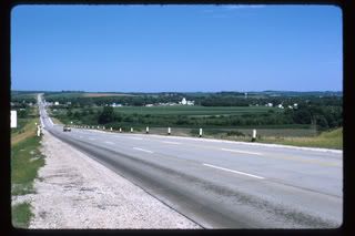
(Those white buildings in the distance are the grain elevators at the Farmer's Co-op on the "edge of town" Famous people from my hometown: Devoted Puppy Kelly Goodburn --played professional football (punter) for the Kansas City Chiefs & Washington Redskins & won a superbowl ring with the Redskins. Ummm, yeah, and that's about it. I wasn't even lucky enough to live in town, I grew up on a farm. 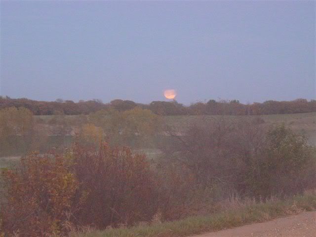
Thank god I got the hell outta there as soon as I could. Now I'm in New York, population 8 million! 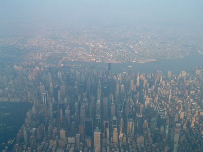
. [Edited 5/22/07 20:29pm] | |
| - E-mail - orgNote - Report post to moderator |

Warren is a town in Knox County, Maine, United States. The population was 3,794 at the 2000 census. The town was part of the Waldo Patent and is located on the banks of the Saint George River. It was settled by Europeans in 1736 and incorporated as a town in 1776.[1]
As of the census2 of 2000, there were 3,794 people, 1,346 households, and 970 families residing in the town. The population density was 31.6/km² (81.8/mi²). There were 1,534 housing units at an average density of 12.8/km² (33.1/mi²). The racial makeup of the town was 97.55% White, 0.29% African American, 0.76% Native American, 0.40% Asian, 0.03% Pacific Islander, 0.05% from other races, and 0.92% from two or more races. Hispanic or Latino of any race were 0.74% of the population. There were 1,346 households out of which 37.1% had children under the age of 18 living with them, 58.8% were married couples living together, 8.5% had a female householder with no husband present, and 27.9% were non-families. 20.1% of all households were made up of individuals and 7.5% had someone living alone who was 65 years of age or older. The average household size was 2.60 and the average family size was 2.98. In the town the population was spread out with 25.4% under the age of 18, 6.9% from 18 to 24, 32.8% from 25 to 44, 24.7% from 45 to 64, and 10.2% who were 65 years of age or older. The median age was 37 years. For every 100 females there were 112.9 males. For every 100 females age 18 and over, there were 118.3 males. The median income for a household in the town was $35,662, and the median income for a family was $41,086. Males had a median income of $30,109 versus $20,638 for females. The per capita income for the town was $15,655. About 3.3% of families and 6.7% of the population were below the poverty line, including 3.8% of those under age 18 and 4.5% of those age 65 or over. Warren is home to the Maine state prison, which has a gift shop that sells inmate-made goods. (The gift shop is in Thomaston at the site of the old prison.) Le prego di non toccare la macchina per favore! | |
| - E-mail - orgNote - Report post to moderator |

DevotedPuppy said: That pic is amazing! Socks still got butt like a leather seat... | |
| - E-mail - orgNote - Report post to moderator |
Ocean said: Like both pics but LOVE the color in this one! Socks still got butt like a leather seat... | |
| - E-mail - orgNote - Report post to moderator |
CynthiasSocks said: That pic is amazing! Thanks! I took it myself from an airplane last summer when I flying back from the hometown. | |
| - E-mail - orgNote - Report post to moderator |